

Drone Mapping & Data That Keeps Your Projects Accurate, On Track, and Under Control
Accurate aerial data that helps you verify progress, avoid costly mistakes, and move forward with confidence.
Drone mapping and aerial data services including 2D maps, 3D models, and site intelligence for planning and analysis.
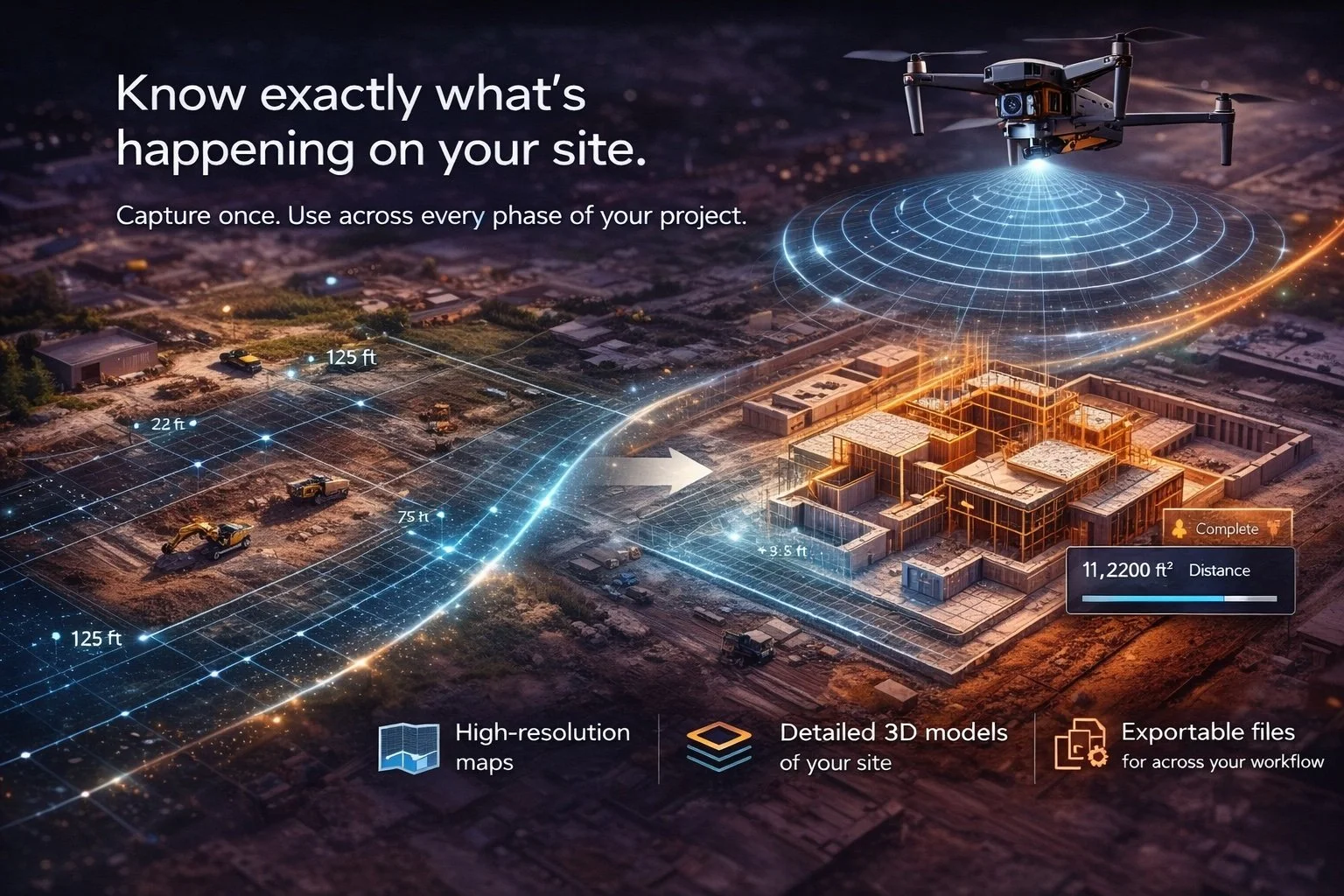
Know exactly what’s happening on your site—so you can avoid mistakes, stay on schedule, and stay in control.
Mapping & Modeling gives you a complete, real-world view of your site from a single drone mission.
Instead of relying on outdated plans or manual measurements, you get accurate, up-to-date data you can trust—helping you avoid errors, reduce rework, and keep your project moving forward.
When your data is accurate, your decisions are faster—and costly mistakes are minimized.
What You Get:
High-resolution orthomosaic maps
Detailed 3D models of your site
Accurate measurements and volume calculations
Overlay capabilities for plans and layouts
Exportable files for use across your workflow
How It’s Used:
Pre-construction planning and site analysis
Progress tracking and verification during builds
Engineering validation and measurement checks
Documentation for reporting and compliance
Mapping & Modeling
Accurate site data captured once—used to plan, verify, and manage every phase of your project.
See the work.
See the difference.
Accurate data that helps you reduce risk, stay on schedule, and keep your project moving forward.
SkyVision provides drone mapping and aerial data services including 2D mapping, 3D modeling, and site analysis. Our aerial data solutions help improve project visibility, reduce uncertainty, and support better planning and decision-making. Ideal for construction, inspections, and site development projects.